AI-powered construction simulation, traffic optimization, excavation mapping, and infrastructure modeling for the cities of tomorrow.
Comprehensive suite of AI-powered tools for modern urban infrastructure management
Predicts impact of new builds on infrastructure & simulates various scenarios with advanced 3D modeling and real-time analysis.
Auto-detects and visualizes excavation zones with precision mapping technology and safety zone calculations.
Monitors congestion and suggests alternate routes with real-time traffic flow optimization and predictive analytics.
AI-generated simulations of city growth and layout plans with advanced predictive modeling capabilities.
Extracts structure outlines from satellite imagery with high precision.
Identifies and classifies post-disaster building damage automatically.
Compare past, present, and predictive urban trends for better planning.
Automated logs showing who approved what, and which regulation was triggered.
Predict zoning, infrastructure, and environmental impacts before implementation.
Test multiple development scenarios with advanced simulation capabilities.
Next-generation features coming soon to revolutionize urban infrastructure management
Verifies if a project qualifies for permit-free status by checking it against technical regulations.
• Automated regulatory compliance check
• Instant permit requirement analysis
• Integration with city databases
Highlight accident-prone zones, traffic hotspots, and overused roads.
• Predictive accident analysis
• Real-time risk assessment
• Historical pattern recognition
Flag zoning conflicts and land-use violations before project approval.
• Automated zoning analysis
• Conflict detection algorithms
• Compliance reporting
Maps priority zones for post-crisis rebuilding and infrastructure restoration.
• Priority zone mapping
• Resource allocation optimization
• Emergency response planning
Powered by cutting-edge AI, machine learning, and computer vision technologies for unparalleled accuracy and performance.
Lightning-fast calculations with instant adjustments based on live data feeds and sensor inputs.
Advanced machine learning algorithms that continuously improve with every project analyzed.
Bank-grade encryption and security protocols with full audit trails for compliance.
Plug-and-play APIs that integrate seamlessly with existing city systems and workflows.
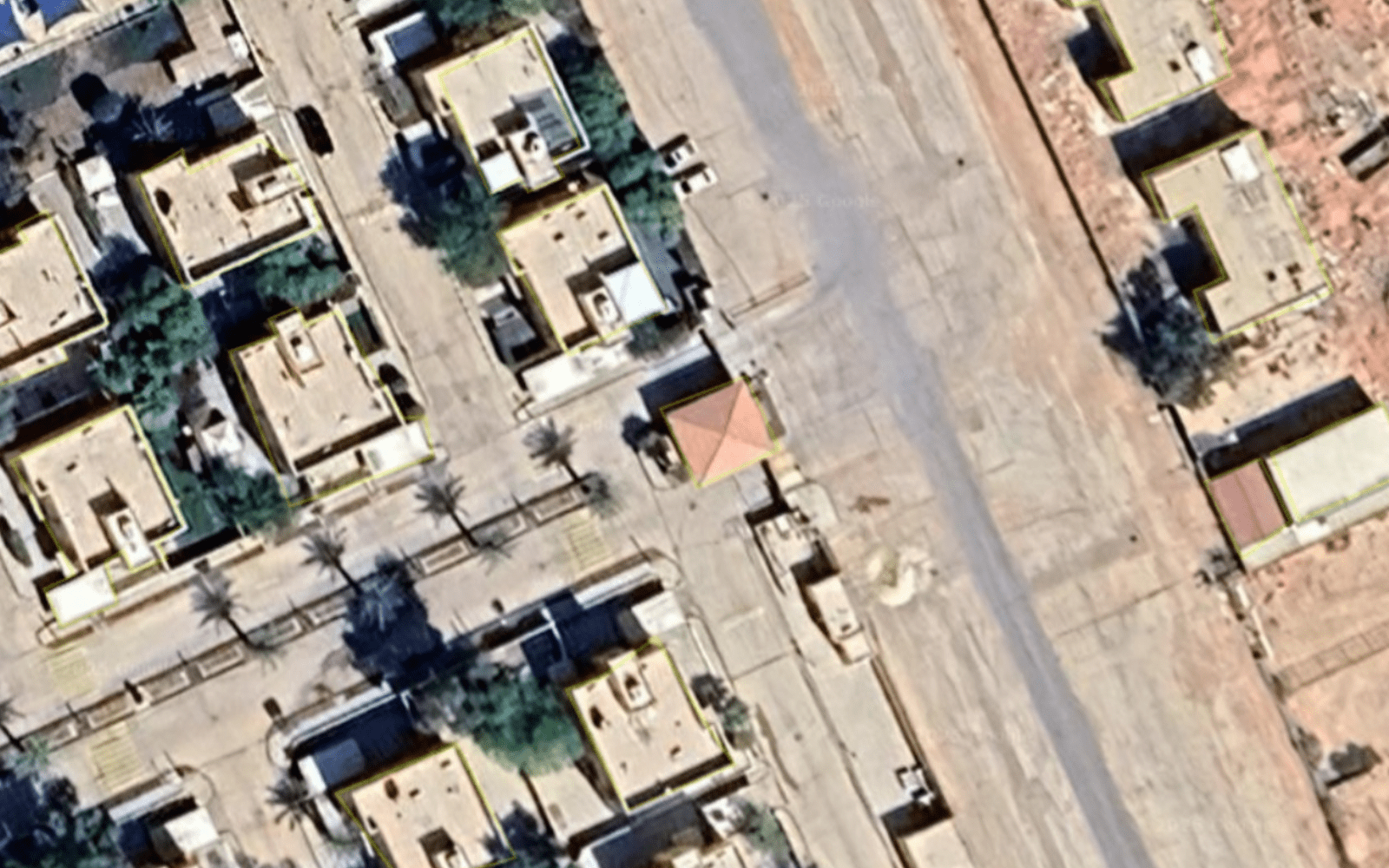
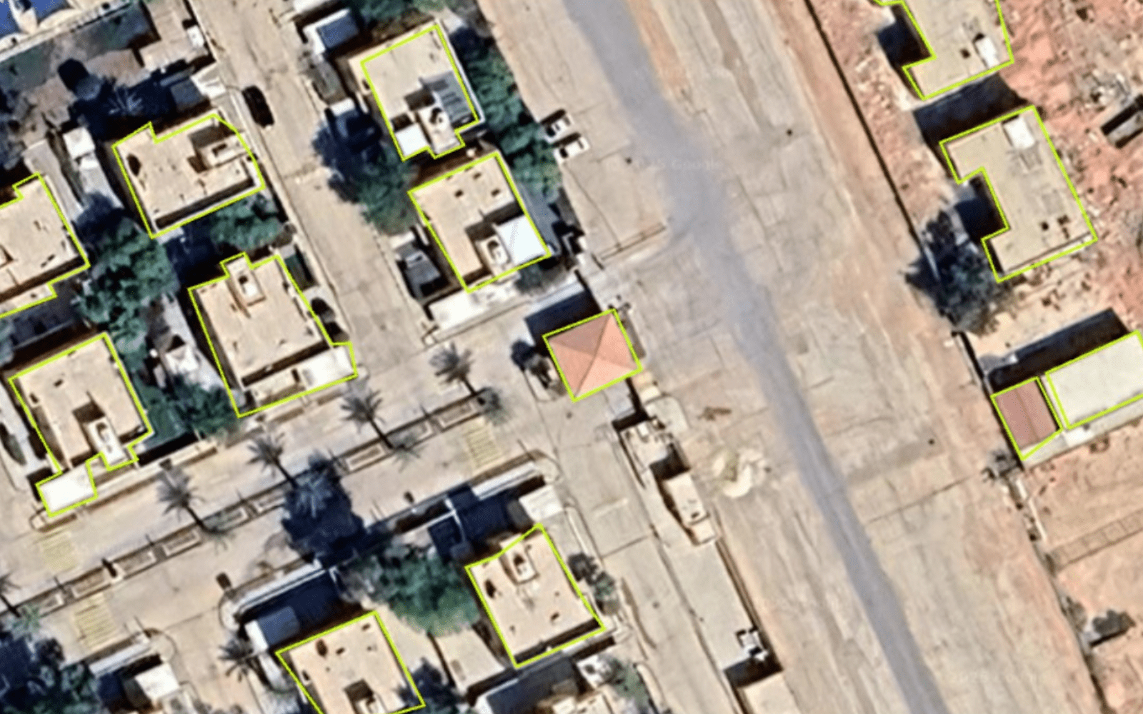
Example: Building Footprint Detection with AI-powered analysis
Tailored solutions for every sector involved in urban development and infrastructure
Complete construction lifecycle management from planning to execution with real-time monitoring.
Comprehensive urban planning tools with growth prediction and infrastructure optimization.
Regulatory compliance, permit management, and policy enforcement automation.
Advanced excavation planning with geological data integration and safety optimization.
Disaster response planning, damage assessment, and recovery zone prioritization.
Critical infrastructure protection with vulnerability assessment and risk management.
Plug-and-play architecture designed to work with your existing systems
Modern, well-documented APIs for easy integration with any platform or technology stack.
Comprehensive dashboards with real-time visualization and customizable widgets.
Export data in multiple formats with full audit trails and compliance reporting.
Join the future of smart city management with TyroPulse's comprehensive platform.